INTRODUCTION:
We had been looking into the various forms of archiving and their purposes through out our Tools &Technology in Art Education course. Dictionary describes archiving as the process of protecting data that is no longer needed for day to day operations by storing it for future reference. While documentation is the actual data being archived. Vastly different array of things from manuals, guides, listings, diagrams, hard copies, soft copies , oral traditions and histories can be documented. Generally archives are not accessible to all and sundry. Usually the relevant people have access to it but in today’s age of information it is imperative that archives and documentation should be attainable by the public at large. Now the question arises should all kinds of archives be made available. This is a difficult question to answer as there are a lot of considerations to be had. But If we talk about the archiving of traditions and histories then it seems probable that anyone should have this information at hand. Especially the oral and ever evolving cultural histories. But accessibility simply does not guarantee usage, while the opposite is also true. Most of the time what is needed is not easily available.
I was already thinking along these lines for my final project for the Tools & Technology in Art Education Course. Simultaneously I was being inspired by all the technological and digital projects that we had reviewed in the duration of our course. These projects had one thing in common: they all looked at existing situations and pointed out a persistent issue, then identified the cause of that issue and addressed the cause rather than the symptoms. I had already discussed this in one of my prior blogs.
SEED OF AN IDEA:
As luck would have it I had been researching old markets of Karachi as a teaching tool, and I hit a roadblock when I looked up these places on internet. I was able to find the exact location of these markets thanks to Google Maps but I was not able to gather any other information about them. Granted that Google Maps have a lot of resources attached in terms of blogs and sites that provide you with the required information like what is sold where and at what prices, even historical backgrounds to some of these places. But I feel that is where the issue lies, all this data is scattered over a huge number of sites and you only go through the ones that SEO brings to the top of the search page. In more cases than not the information is either not authentic or repetitive.
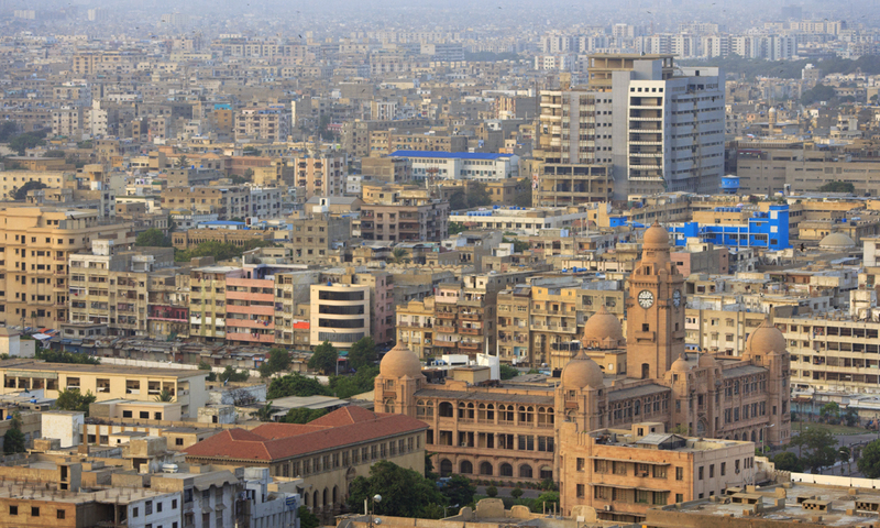
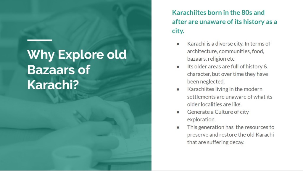
If there is one thing that Karachi is known for it is diversity; in terms of people, communities, architecture, purpose of places, food, clothes , religion and the list goes on. The maps available are not able to convey this quality of the city. Karachi is a sprawling city, its growth has been organic and unchecked. Old settlements have mingled with new. Due to the expanse of the city itself people living in one area are not aware about the other locations within the city. This made me realize that older localities are not regularly visited by the all of its citizens.
The original settlements of Karachi have a particular charm and character that is unique to them owing to the communities that established those areas and their current generations that are still living there. They are witnesses to its evolution or decay therefore only they can relate the authentic feel of the place and its true history. In most blogs or sites their voice is usually missing.
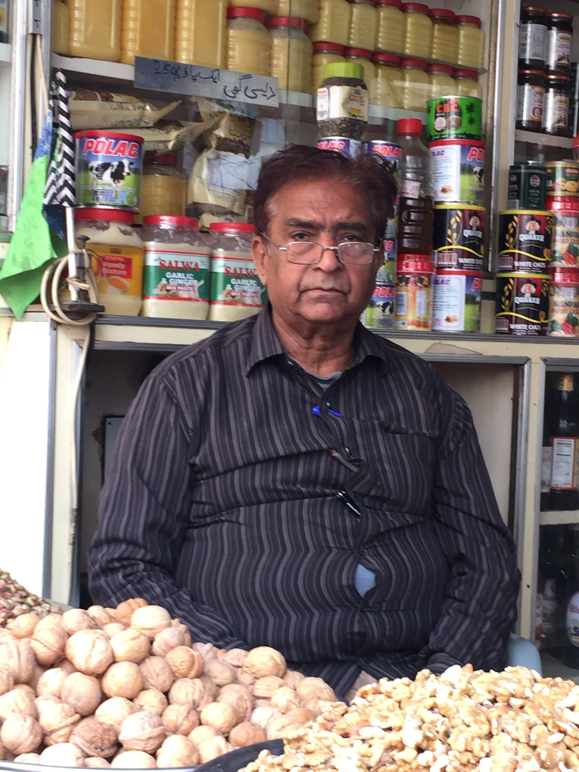

Local dry fruit seller in Sarafa Bazaar
As mentioned earlier most Karachiites have all heard of these places but have not visited them. I am a strong believer in exploring one’s own town, city, country before going outside. Karachiites who have grown up in the modern settlements should come and explore the older places so that they can pass on the heritage to their younger generations. They also have the resources to help develop and flourish the older parts of the city.
Since my starting point was archiving and problem solving and a problem was staring me in the face waiting to be solved. I thought why not work with maps! Maps after all are a form of documentation and archiving. They are a simple visual representation of locations. They are so simple that they are devoid of any sentiment; they are objective in their very nature. And That’s what I strongly felt was missing in the maps and blogs representing these areas; sentiments! As a result they are not a true representation of Karachi. This particular character of the old city is of essence to pique people’s interest.
I had my Aha! Moment. But the question remained how to make the maps more than a mere visual representation.
IMPLEMENTATION:
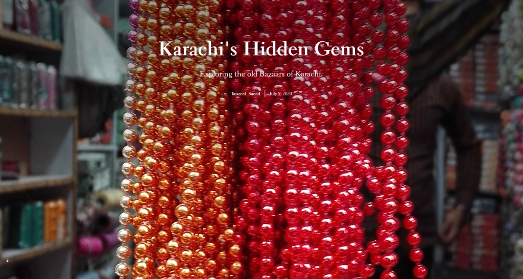
CLICK HERE TO EXPERIENCE THE STORY MAPS – KARACHI”S HIDDEN GEMS
This is the final result for the pilot. Here I have tried a variety of Story Maps in which I was actually exploring the site and its features. I rather enjoyed the process and understood its potential.
PROCESS WORK:
The process behind the final piece is always complex and spread over various branches. It is never glamorous but its importance cannot be denied to reach the end result. I am sharing my thought process behind the Story Maps. Since I am old school I initially worked with pen and paper. And made these huge mind maps deciding in which direction to go.
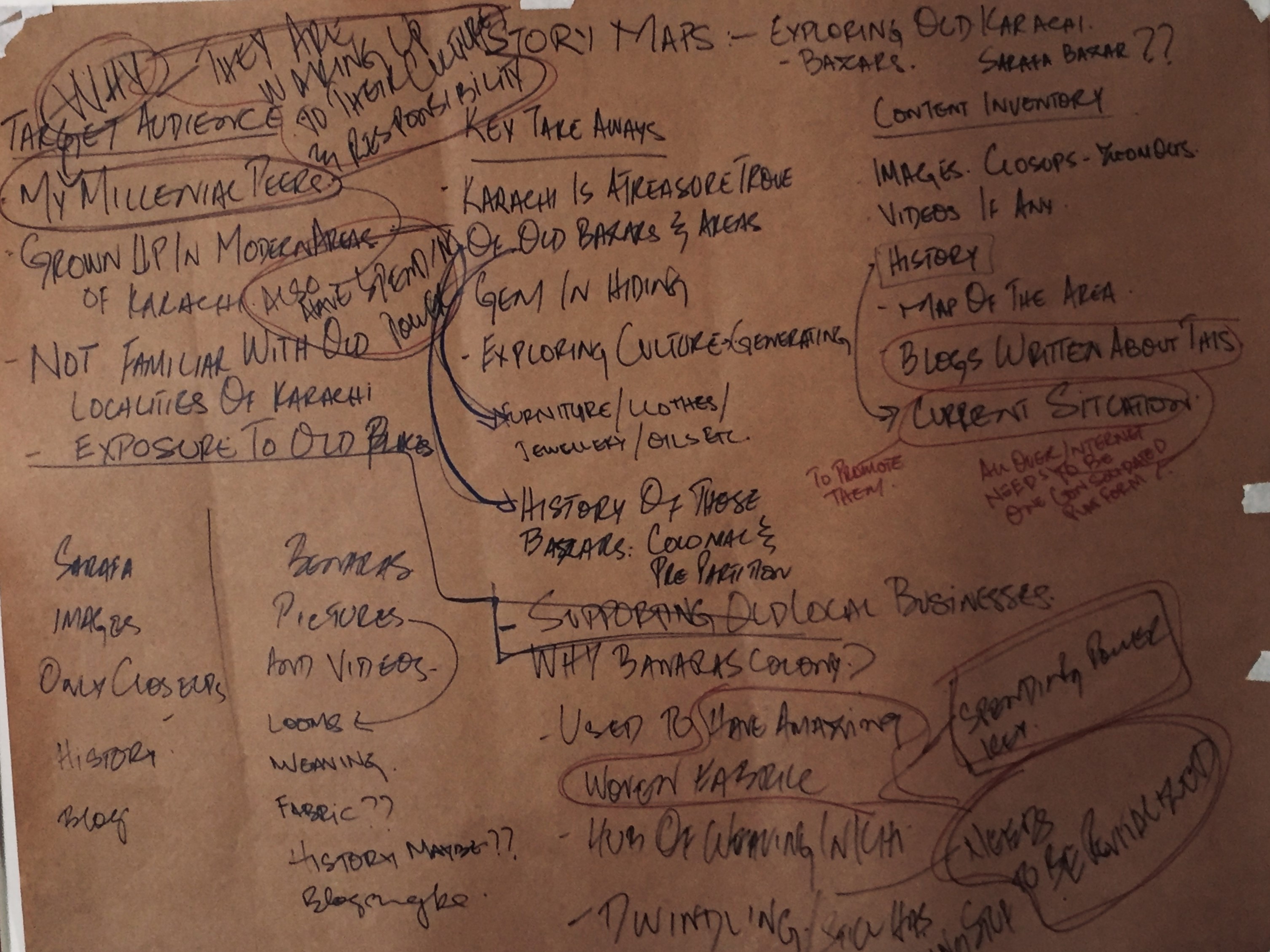


Initial Mind Maps
Then I streamlined these into One major mind map and a wireframe of sorts telling me the steps that need to be taken to achieve these.
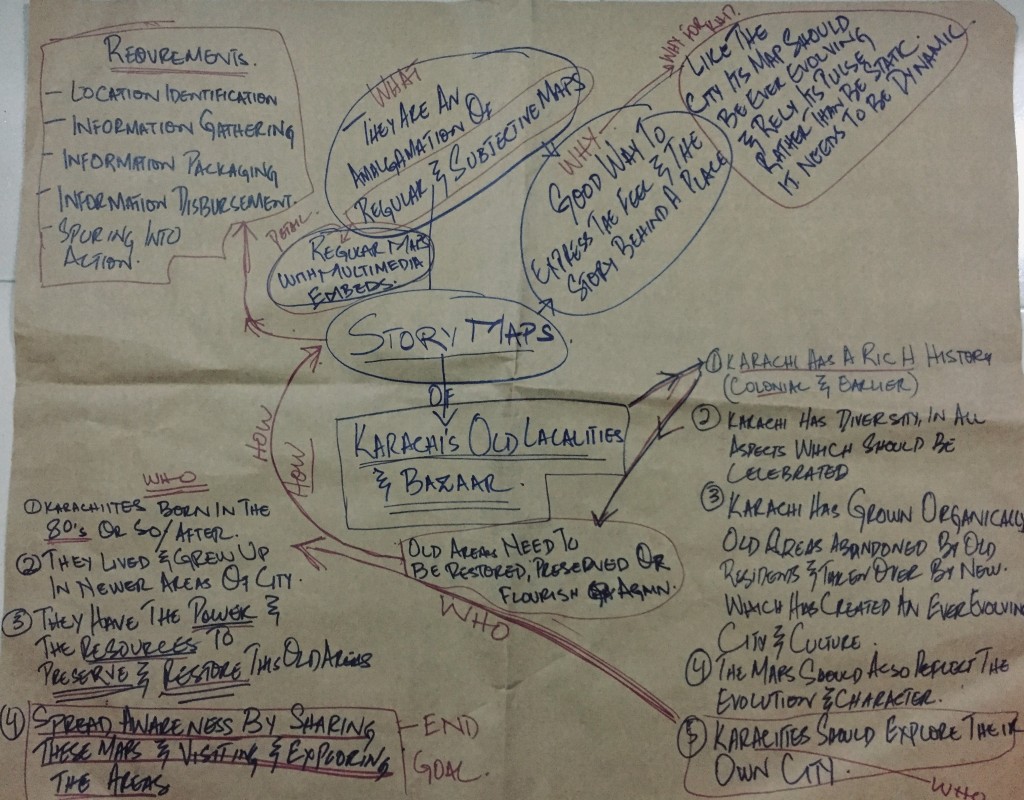


Step by step Planning
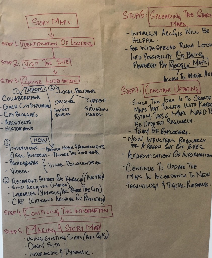
COMPLETE WIRE FRAME.
RESEARCH:
DIGITAL EXPLORATION:
I started my research with looking into the kinds of maps available and being used online. My first idea was interactive maps that can give directions and information both. But interactiveness turned out to be a superficial feature as the essence of the location was not coming through. I have already established that local residents’ input is essential to achieve this.
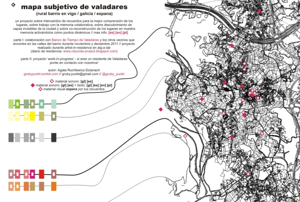
I then came across subjective maps. They give the feel of the location based on the curator’s perspective and the locals’ account of that place. As the name suggests it gives the feel of a place from a very subjective point of view. But not necessarily the directions. I was looking for something that can combine the two.
Further research brought me to a relatively new concept of Story Maps where the maps give the directions as well as the narrative of the place.This idea hit a chord with me. I further looked into this. Story Maps basically is a way to narrate a story or history of a place on the map through embedded text, images, videos and other multimedia options. Almost similar to Subjective Maps but difference lies in the fact that information from different perspectives could be added and they can possibly give directions as well.
This could truly be it! multimedia embeds could potentially be used to describe the feel of the location along with its history in the residents’ own words. Story Maps Online is one of the digital platforms owned by ArcGIS. ArcGIS is a geographic information system (GIS) for working with maps and geographic information maintained by the Environmental Systems Research Institute (Esri). These maps can be used to showcase anything therefore I decided to work with them.
TARGET AUDIENCE & DATA COLLECTION:
I was simultaneously figuring out why it is important for me to make these maps and whom to target. In My opinion Millenial Karachiites who were born in the 80’s and grew up in the newer areas of Karachi were the prime people to aim for. This demographic is not only educated and tech savvy a lot of them also take ownership for Karachi.

There is a developing culture of city walks in Karachi where different organizations arrange walks around the old parts of the city but they are mostly organized on Sundays when businesses are closed and the streets are devoid of the usual hustle bustle. People still avoid going to older areas due to traffic and preconceived security concerns. These maps will allow Karachiites to explore older parts of the city from the comfort of their homes. Few of the groups are theHeritageWalk, theLocaltrails and last but not least theKarachiwalla. They all are a great information resource of the old city and they all have a different take on the city. I feel there is a need for one consolidated platform where all the information is available yet it is entertaining enough to make people explore older parts of Karachi.
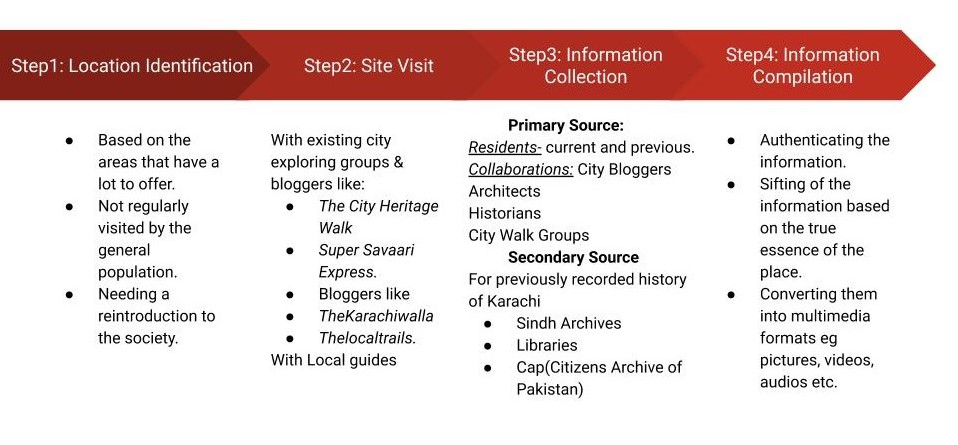
For collecting information as I have discussed in my wire frame, it is imperative to collaborate with not only the locals of these places but also with Karachi’s architects, historians, bloggers and other city explorers. This will provide with multiple perspectives to gain insight into the city’s character. Along with these, libraries and Sindh Archives would also be used for written historical facts and cross checking of the information.
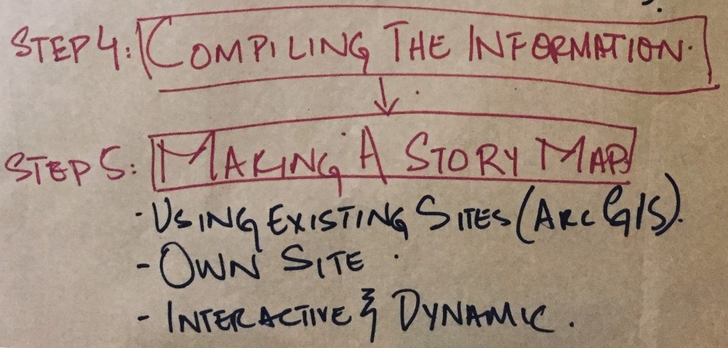
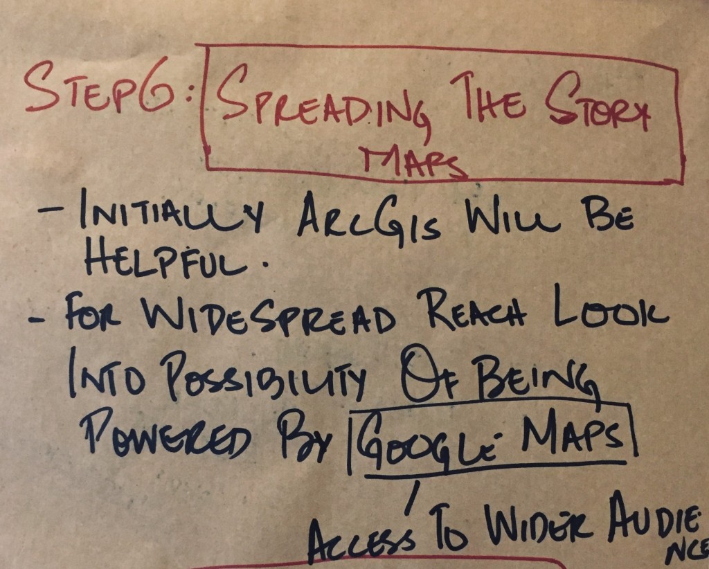
Following are the steps needed to be taken to create these Story maps of Karachi. Once the work starts the story maps will be expanded on these foundations.

Step by Step Wireframe
CREATING STORY MAPS OF KARACHI”S OLD BAZAARS:
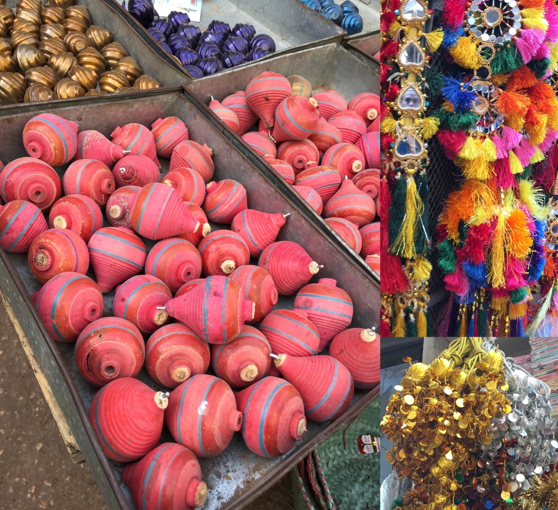
Since I had already decided to document the old areas of Karachi as Story Maps I started looking into the possible locations for my pilot project. There is no better way to convey the feel of a city than exploring its bazaars and in this case specifically old bazaars. Since some of these markets have been around before colonial times, most of the old bazaars of Karachi have been through tremendous changes and upheavals and have seen history unfold. And its residents and people must definitely have some amazing stories to relate.
Plan was to physically go and record information through visuals and audios of locals’ viewpoint, that could not happen due to lock down caused by the Covid-19 pandemic. Therefore the blog TheKarachiwalla was a great resource for me at the moment given that it has the history as well as recent pictures of these places. He has also talked to locals and their perspective on living in these localities. So I borrowed a lot of information and images from his blog with his consent of course. And tried making maps with this information as an initial idea which I feel can lead to further research and proper standalone site on its own in the future. Since I am not a tech savvy person I simply tried it as a sample.
I began exploring ArcGIS StoryMaps. It is like a blog except that maps and mappings are the central element of the experience. And there are quite a few ways of making these maps and consequently narrating your story.
There were 3 main types of maps available on ArcGIS StoryMaps. I played around with them to see which one was better suited for what I was trying to achieve.
EXPRESS MAPS:
There is an embed for express maps. An excellent way to give a quick overview of the place with images and text information embedded into the location pin. I created one with an overview of some of Karachi’s Old Bazaars and settlements in various locations.

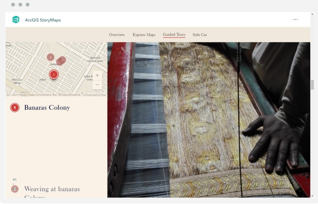
GUIDED TOURS:
Another amazing feature is the guided tour which is helpful and interactive. It takes the viewer on a journey over the map and you can add pictures and videos of these places while you scroll over the map. Almost like a virtual tour.
Here I tried two options, with 2 different locations of Karachi. The one with Sarafa Bazaar: has just the images and the other of Banaras Colony: has images and videos both to help the viewer understand character and the nature of the work happening in that location.
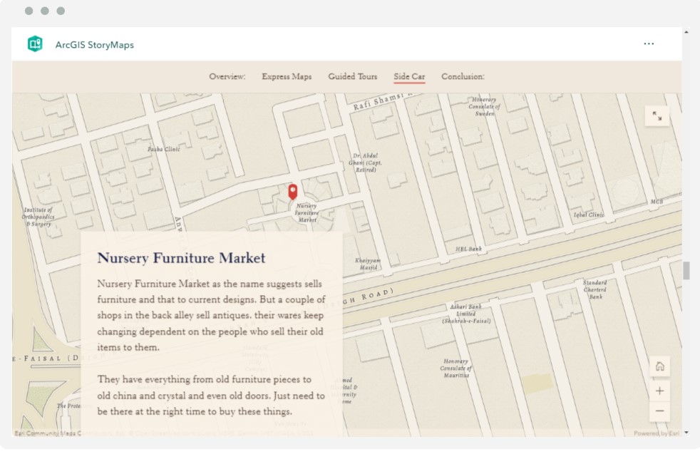
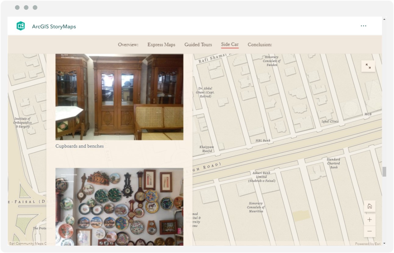
SIDECAR:
Third was the sidecar feature. In this option you can layer images, videos and audios on to a base image. The base image could be of an actual scene of the city or it could be the map of the location. A lot of information can be shared with the side car option.
I tried to cover Antique markets of Karachi in this option and have shown three such bazaars. For Saddar’s Antique Market and Framer’s Gali I used base image of the Bazaars themselves with the supporting pictures in the Sidecar. While for the Nursery Furniture Market I have used the express map of the location as the base image with supporting pictures in the Sidecar.

PHONE VERSION
Site also shows you previews of how the Story Maps will look on various devices including browser, desktop, tablets, and phones. Below I have shared the screenshot of how they will look on a phone.
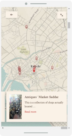

Left: Express Map Right: Guided Tour
FUTURE PLANNING:
In future, collaboration with other explorers is the way forward to contribute to these maps. An entire team needs to be set up which decides themes for these maps and then forward it to city explorers who can organize events and go around the city and gather information and keep updating these maps. The Idea is that since a place is never static it keeps changing with new people,communities and events so should its maps and the diversity should be visible in the various vantage points.
Maybe in the future these could be developed as apps for phone that would also give real time directions to the viewer of the Story Map. Another idea is to get these powered by Google Maps to increase the spread and accessibility.
CONCLUSION:
Right now what I have shown are very initial sample Story Maps of Old Bazaars of Karachi. After the initial documentation of these places more in depth work can start. Where each place can be looked at in detail while talking to the residents about its history and the current situations. Since Exploring Karachi is the main theme behind this endeavor the maps can be branched out into more categories like food, fashion, architecture, religious places etc the possibilities are endless.
Credits and Resources
I am gracious to the Karachi Walla for allowing me to use his information and the images without which I would have not been able to achieve this.
Photo Credits: The Karachi Walla, Tanzeel Saeed
Information: The Karachi Walla, dawn.com, express tribune.
Digital resources: googleslides, ArcGIS StoryMaps
